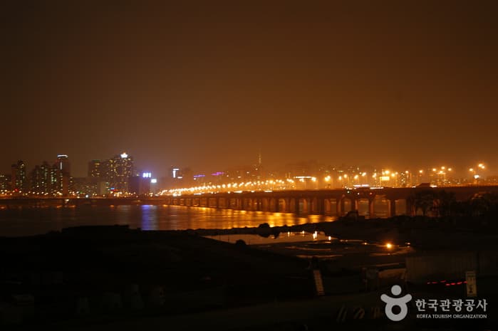
Mapodaegyo Bridge (마포대교 야경)
Mapo-dong, Mapo-gu, Seoul
About
Experience the stunning glow of Seoul from Mapodaegyo Bridge at night. This popular spot offers picturesque, panoramic views of the Han River skyline and the bridge’s illuminated structure. It's a perfect romantic destination for couples or anyone simply seeking a beautiful evening wander. For the best atmosphere and photography opportunities, visit after sunset. Mapodaegyo is a must-see attraction any time of year!
View original description
Visitors also explore Samsung Store Mapo [Tax Refund Shop](삼성스토어 마포), Lunette Eyewear - Mapo Branch [Tax Refund Shop] (루네뜨안경 마포) and Gwangsil Pharmacy [Tax Refund Shop](광실약국) near this location.
Location
37.53647, 126.94184
More Attractions in Seoul

Yeouido Park (여의도공원)
68, Yeouigongwon-ro, Yeongdeungpo-gu, Seoul
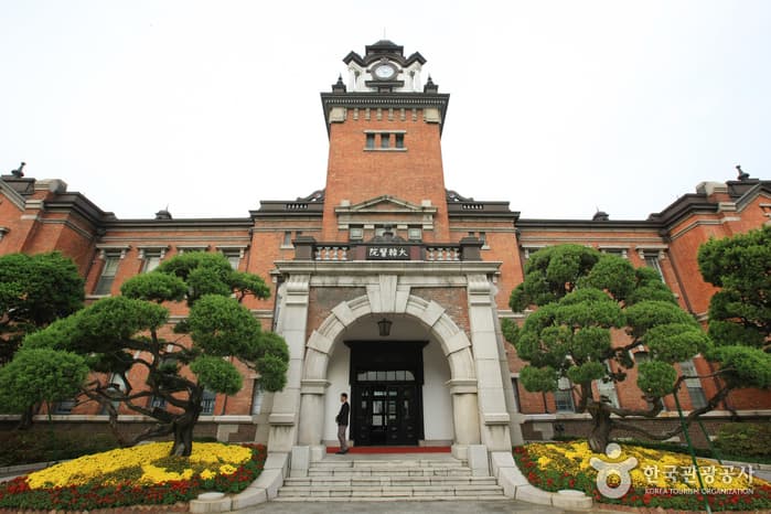
Seoul Daehan Hospital (서울 대한의원)
101, Daehak-ro, Jongno-gu, Seoul
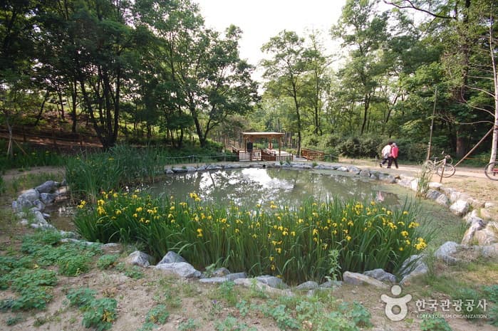
Gwanaksan Ecological Park (관악산 생태공원)
Seongsu-dong, Gwanak-gu, Seoul

Jungmyeongjeon Hall (중명전)
41-11, Jeongdong-gil, Jung-gu, Seoul

Le Miel Plastic Surgery (르미엘성형외과의원)
3rd Floor, 120 Jongno, Jongno-gu, Seoul
DL Plastic Surgery (디엘성형외과의원)
(4th Floor, Peyto Plaza), 563 Gangnam-daero, Seocho-gu, Seoul
Nearby Places
](/_next/image?url=https%3A%2F%2Ftong.visitkorea.or.kr%2Fcms%2Fresource%2F85%2F4024785_image2_1.jpeg&w=3840&q=75)
Samsung Store Mapo [Tax Refund Shop](삼성스토어 마포)
299, Tojeong-ro, Mapo-gu, Seoul
](/_next/image?url=https%3A%2F%2Ftong.visitkorea.or.kr%2Fcms%2Fresource%2F04%2F2888904_image2_1.jpg&w=3840&q=75)
Olive Young - Dohwa-dong Mapo Branch [Tax Refund Shop](올리브영 마포도화점)
20, Samgae-ro, Mapo-gu, Seoul
![Olive Young - Mapo Station Branch [Tax Refund Shop] (올리브영 마포역)](/_next/image?url=http%3A%2F%2Ftong.visitkorea.or.kr%2Fcms%2Fresource%2F94%2F2888894_image2_1.jpg&w=3840&q=75)
Olive Young - Mapo Station Branch [Tax Refund Shop] (올리브영 마포역)
1F, #115, 53, Mapo-daero, Mapo-gu, Seoul
![Lunette Eyewear - Mapo Branch [Tax Refund Shop] (루네뜨안경 마포)](/_next/image?url=http%3A%2F%2Ftong.visitkorea.or.kr%2Fcms%2Fresource%2F84%2F2878384_image2_1.jpg&w=3840&q=75)
Lunette Eyewear - Mapo Branch [Tax Refund Shop] (루네뜨안경 마포)
1F, 24, Dohwa-gil, Mapo-gu, Seoul
](/_next/image?url=https%3A%2F%2Ftong.visitkorea.or.kr%2Fcms%2Fresource%2F26%2F4022526_image2_1.jpg&w=3840&q=75)
Gwangsil Pharmacy [Tax Refund Shop](광실약국)
1F, Samseong Plaza Shopping Center, 32, Dohwa-gil, Mapo-gu, Seoul
](/_next/image?url=https%3A%2F%2Ftong.visitkorea.or.kr%2Fcms%2Fresource%2F56%2F4024656_image2_1.jpeg&w=3840&q=75)
Mapo Samseong Pharmacy [Tax Refund Shop](마포삼성약국)
1F, 33, Dohwa-gil, Mapo-gu, Seoul